LOS ANGELES — An unprecedented fourth "particularly dangerous situation" fire weather warning took effect Tuesday morning and is expected to last through Wednesday.
The National Weather Service reserves the designation for signifying an extreme red flag warning, when especially hazardous fire weather conditions are expected.
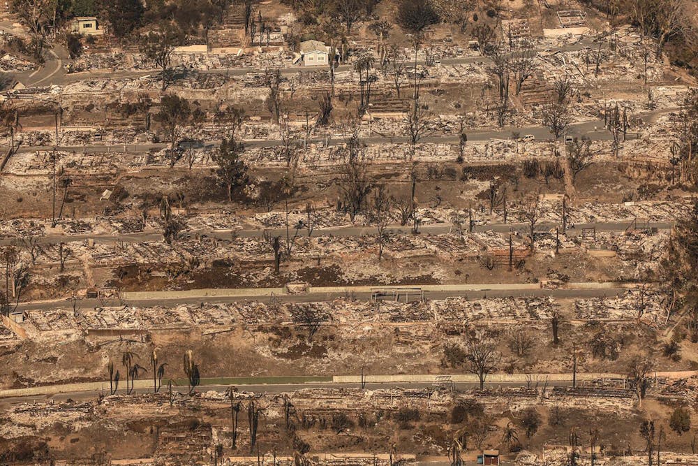
During each of the three warnings issued this season, destructive wildfires erupted: the 19,904-acre Mountain fire in Ventura County, which razed more than 240 buildings; the 4,037-acre Franklin fire, which spread rapidly in Malibu and destroyed 20 buildings in December; and last week's Palisades and Eaton fires, which now rank among the deadliest and most destructive in modern California history.
Why are forecasters so concerned?
The "particularly dangerous situation" tag has traditionally been used by National Weather Service offices only rarely, when forecasters believed long-lived, strong and violent tornadoes were possible. The National Weather Service office in Oxnard, which covers L.A., Ventura, Santa Barbara and San Luis Obispo counties, adopted it in 2020 in hopes of clearly ringing the alarm bell for the most extreme fire weather conditions.
"Any kind of red flag warning is dangerous. But there's a gradient even within that range of situations, and so we wanted a way to message the extreme of the extremes. And the PDS is what came from that," said weather service meteorologist Ryan Kittell.
Timing
The "particularly dangerous situation" went into effect at 4 a.m. Tuesday and will last through noon Wednesday for swaths of Los Angeles and Ventura counties.
Areas impacted
Areas covered by the latest alert include Camarillo, Fillmore, Northridge, Simi Valley and Thousand Oaks. A conventional red flag warning — for a combination of strong winds, dry air and vegetation, and expected severe wildfire behavior if ignition occurs — is in effect across the region, including large portions of L.A., San Diego, Orange, Riverside, San Bernardino and Ventura counties, as well as some mountainous areas of Santa Barbara and San Luis Obispo counties.
Forecast
There have already been strong gusts. On Tuesday morning, a peak wind gust of 72 mph was detected in the San Gabriel Mountains.
There is potential for rapid growth for new fires that start. And with the Palisades and Eaton fires still burning, "these winds can definitely stir up some of those hot spots and kind of reignite the fires," Kittell said.
Winds could wax and wane throughout the alert period, forecasters caution.
"If you do encounter a lull, don't anticipate that the event is over or that the forecast is busted," Kittell said. "Stay vigilant all the way through Wednesday, as the winds can really peak at any time."
This event will be a more conventional Santa Ana, with winds coming out of the east and spreading fires to the west. That means the winds will have more of a focus on Ventura County compared with those last week, which came generally out of the north and hit Los Angeles County hard.
"It'll definitely be more focused in [specific] areas, as opposed to widespread, like we saw last week," Kittell said.
Power issues
Localized power outages and downed trees are expected, although to a lesser degree than last week, according to Kittell.
Winter fires
Usually, at this time of year in Southern California, "the ground is wet, the grass is greening up, and you don't have vegetation that is brittle," said weather service meteorologist Alex Tardy. "You typically also don't have back-to-back-to-back Santa Ana winds."
By his count, the region is headed into its fourth Santa Ana wind event just since last week's catastrophic firestorms.
The extreme fire weather is also being fed by extraordinarily dry conditions. The last significant rain in downtown Los Angeles was on May 5, when 0.13 inches of rain fell. Since Oct. 1, only 0.16 inches of rain has fallen there — a drop in the bucket compared with the historical average of 5.34 inches that should have fallen by this point in the season.
The last time there has been so little rain between early May and the end of December was 1962, where downtown L.A. got only 0.14 inches, according to Rose Schoenfeld, a National Weather Service meteorologist.
"We're certainly very close to the extreme record for a dry, dry start to the winter," Kittell said.
"In my view," said retired climatologist Bill Patzert, "the past nine months has been one of the driest in the historical record going back to 1900. During my career, I've never seen punishing Santa Ana events so overwhelm the normal winter rain season."
There weren't many red flag warnings, or fires, for the last couple of years. For the water year that ended Sept. 30, 2024, downtown L.A. got 22.15 inches of rain; for the prior year, it got 31.07 inches. The average annual rainfall for downtown L.A. is 14.25 inches.
There should be some relief and improving conditions starting Wednesday night. On Friday and Saturday, the winds will be coming from the ocean, and humidity will increase, although gusty winds could still be a problem in certain areas, such as the Antelope Valley and southwestern Santa Barbara County.
But that relief may be brief. There are signs that another Santa Ana wind event could materialize Sunday and Monday, including a 30% to 40% chance of red flag warnings returning for L.A. and Ventura counties.
Is there any relief in sight?
Next week's fire weather probably won't be "nearly as strong" as last week's, Kittell said, but even that silver lining is dampened by the complete lack of rain in the near-term forecast.
At the moment, there are no significant chances for rain for L.A. through Jan. 25.
___
©2025 Los Angeles Times. Visit at latimes.com. Distributed by Tribune Content Agency, LLC.


